CERONAV provides the most performant Navigation Simulator in the Black Sea Basin.
Complete Navigation Missions Simulator includes:
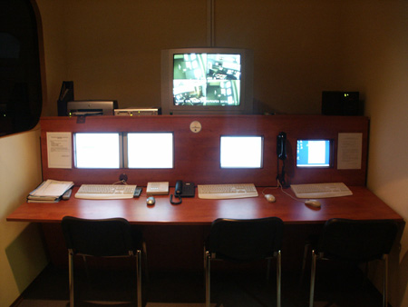
- Tracing, recording and surveillance system
- VTMIS Operator workplace
- Debriefing Room (including the visualisation channel)
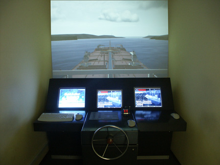
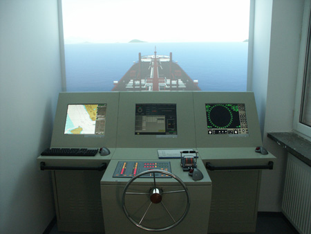
Simulator comprises 5 decks , out of which 4 decks with 30 degrees visualization capacity and 1 deck with 240 degrees capacity. All decks are Bridge Integrated System with the possibility of visualization of 360 degrees (operator’s option).
– 20 world areas with the main ports and maritime routes
– Simulation can be done for more than 10 different types of vessels between 10.000 TDW and 300.000 TDW, including a complex tug
– It can be connected with Engine Room Simulator!
Simulator can be used for several navigation fields :
– maritime navigation including ECDIS
– Radar Plotting / ARPA Navigation
– Hyperbolic and radio navigation (LORAN and GONIO system)
– Electronic Navigation and GPS and UAIS identification
– Inshore navigation and astronomical
– Ice navigation
– Ship’s maneuvering in different meteo conditions and in hazardous areas
– Communication system between and land using GMDSS console
– Containership (83105 t) with main engione MAN B&W (57200 kW 94 RPM);
Imagini Simulator